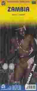
ZAMBIA
mapa w skali 1:1 500 000
kandyjskiego wydawnictwa ITMB Publishing
plan Lusaka
plan Livingstone
opisy i tabela odległości pomiędzy miejscowościami
ITMB Publishing (International Travel Maps and Books) producentem map i atlasów krajów i regionów całego świata. Specjalizującą się w Afryce, Azji, Kanadzie, Karaibach, Europie, Bliskim Wschodzie i Ameryce Łacińskiej.
ITMB wydało juz ponad 425 pozycji kartograficznych i stale pracuje nad nowymi wydając rocznie około 30 nowych tytułów.
Tourism to Zambia is at an all-time high, thanks to the utter collapse of neighbouring Zimbabwe. Why? Well, Victoria Falls is easily accessible from Liningstone, and Zambia has ramped up its tourism infrastructure to take advantage of the pent up demand to see one of the great wonders of the world. Zambia is also proving to be a stable and reasonably democratic state, and progressing accordingly. This map updates everything ITMB have been able to find about the country.
The map distinguishes roads ranging from major paved roads to tracks. Railroads, international and national airports, aerodromes and ports are all clearly marked, as are petrol stations, post offices, border crossings, hospitals/medical facilities, points of interest, vistas, ruins/archaeological sites, mines, museums, campsites or huts, rest houses/hostels/bungalows, missions and ferries.
There is also an inset map of Lusaka and another of Livingstone that show some accommodation options and various other facilities.
|

