| USA południowy-zachód mapa 1:1 000 000 ITMB / 978[zasłonięte][zasłonięte]34148 |
  
|
Informacje dodatkowe:
| Rodzaj produktu: | mapa samochodowa | | Wydawca: | ITMB | | Skala: | 1:1 000 000 | | Język: | angielski | | Oprawa: | miękka | | Wodoodporna: | Tak | | Ilość stron: | 2 | | Wymiary / mm: | 100 x 245 | | Waga / gr: | 85 | | Indeks: | miejscowości | | EAN: | 978[zasłonięte][zasłonięte]34148 | | ISBN: | [zasłonięte]978-1541-484-1 |
|
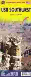
| A few months ago, ITMB released its new map of the Northwest Pacific Region (essentially, Washington, Oregon, and Idaho). Now we're introducing a map of the US Southwest States, notably most of California and Nevada, Arizona, most of Utah, and the western third of New Mexico and Colorado. Our regional series is at 1:1M scale. This results in instances where the name of the map may differ from the common perception. In US parlance, the 'Southwest' is often thought to be Arizona and New Mexico, whereas in reality it is southern California, Nevada, and Arizona. If one includes New Mexico, the square sheet of paper has to go so far north that one ends up including Denver. This is our compromise and we'll figure out how to deal with Texas, New Mexico, Louisiana, and Oklahoma a bit further down the line. This double-sided map covers from Reno and Sacramento in the north to Tijuana and Deming NM in the south, and from the Pacific coastline in the west to Gallop NM and Grand Junction CO in the east; printed on durable ITM plastic paper. As with all US regional maps in our growing coverage, this map includes towns, roads, physical features, major parks and natural monuments, touristic attractions, and border crossings.Legend Includes:Roads by classification, Airports, Ferrie routes, States boudaries, border crossing, Time zones, Dams, Harbours, State parks with or without campsites, Campsites, Wayside or Roadside parks, Hospitals, Museums, Tourist information centers, Points of interest, Spanish mission, Waterfalls, World heritage sites, Viewpoints, Lighthouses, Springs, Hot springs, Beaches, Mines and quarries, Nature reserves, Indian areas, Ranger stations, Caves, Universities, Golf courses, Skiing, Snowparks and much more. |
| |
|
|
| Jak możemy pomóc? |
 |
| Dostawa, płatności |
 |
|