| USA Północno-Zachodni Pacyfik mapa 1:1 000 000 ITMB / 978[zasłonięte][zasłonięte]34111 |
Informacje dodatkowe:
| Rodzaj produktu: |
mapa turystyczna |
| Wydawca: |
ITMB |
| Skala: |
1:1 000 000 |
| Język: |
angielski |
| Wydanie: |
I |
| Oprawa: |
miękka |
| Wodoodporna: |
Tak |
| Ilość stron: |
2 |
| Wymiary / mm: |
105 x 245 |
| Waga / gr: |
71 |
| Indeks: |
ulic |
| EAN: |
978[zasłonięte][zasłonięte]34111 |
| ISBN: |
[zasłonięte]978-1541-111-6 |
|
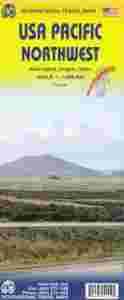
USA Pacific Northwest: Washington, Oregon, and Idaho Travel Reference Map on waterproof paper, 1st Ed. 2013 1:1,000,000 - The USA is a series of regions. One of the best known is New England; another is the Pacific Northwest, which is generally accepted consists of the states of Washington, Oregon, and Idaho, with maybe a tiny portion of British Columbia on the north and a bit of California/Nevada on the south. We selected 1:1M scale to represent the region as a double-sided map on waterproof paper. It starts in Vancouver in the north and goes to Eureka and Redding in the south. Side 2 includes a fair amount of Montana, as must be expected, given the shape of Idaho. The easternmost border of Idaho is in a direct line with both Bozeman and Great Falls, MT. This is an excellent travel map for the region. The scale used opens up the grandeur of this vast expanse of land, showing all highways and secondary routes, and noting significant sites for visitors to explore, whether that would be Squaw Creek Canyon, Winthrop, WA, or the Old Perpetual Geyser in Oregon. I'm afraid that space constraints limited insets to Seattle, but hundreds of parks and wilderness reserves are included, as well as Interstate rest areas, campsites, beaches, and of course Coeur de Lion (Heart of the Lion), since corrupted to Coeur d'Alene.Legend Includes:
Roads by classification, Points of Interest, National Parks, Rest Areas, Lodges, Airports, Information Centres, Golf Courses, Hot Springs, Border Crossings, Gas Stations, Universities, Museums, Ski Areas, Lighthouses, Beaches, Caves, Campsites, Indian Reserves, Springs, Waterfalls, Ranger Stations, Viewpoints, Harbors, Monuments, Nature Reserves, World Heritage Sites, Spanish Missions, Mine, Dams, Snowparks, and much more. |
|
|