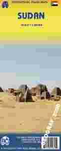
SUDAN
mapa w skali 1:2 500 000
kandyjskiego wydawnictwa ITMB Publishing
ITMB Publishing (International Travel Maps and Books) producentem map i atlasów krajów i regionów całego świata. Specjalizującą się w Afryce, Azji, Kanadzie, Karaibach, Europie, Bliskim Wschodzie i Ameryce Łacińskiej.
ITMB wydało juz ponad 425 pozycji kartograficznych i stale pracuje nad nowymi wydając rocznie około 30 nowych tytułów.
This latest edition comes out at a time when the largest country in Africa needs a good map the most. Sudan is not a country with an improving infrastructure, nor is it one of the safest countries for travellers. However, its position in Africa makes it pivotal to the politics and ethnicity of much of northeastern Africa, and its importance can be gauged by the fact that this ITMB title is already into its third edition.
It is one of the most difficult countries in the world to map, simply because so much of it is difficult to enter. ITMB have dedicated this map to those brave souls who continue to provide food and medical support for all the peoples of Sudan - the humanitarians, whose contributions have made this map possible.
National parks, wildlife reserves and other protected areas are highlighted and symbols mark archaeological sites, mosques and churches, campsites and other selected accommodation. The map is indexed and also includes a small street plan of central Khartoum indicating various facilities and places of interest.
|

