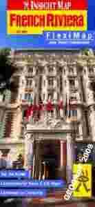
laminowana mapa samochodowa RIWIERY FRANCUSKIEJ
1:225 000
MAPA W JĘZYKU ANGIELSKIM
mapa zawiera:
MAPA LAMINOWANA
Doskonała i niezawodna mapa laminowana brytyjskiego wydawnictwa Insight oferującego ponad 500 tytułów map i przewodników całego świata.
Mapy Insight Flexi Map to papier wodoodporny po którym bez problemu można pisac ścieralnymi pisakami. Zawierają liczne plany i mapy przedstawiamego regionu. Szczgółowa kartografia i wspaniale opisane atrakcje turystyczne czynią te mapy doskonałym towarzyszem podróży gwarantując niezapomniane wrażenia.
Mapa jest bardzo poręczna i bez problemu składa się nie zajmując zbyt wiele miejsca.
Part of the Insight Flexi Map range, this map of French Riviera gives you everything need from a durable, ultra portable, folded sheet map. This publication contains seven maps, including French Riviera, Antibes, Monaco, Cannes, Central Nice, Nice and a locator map of the south of France. It also lists Top Ten recommended sights - from magical Monte Carlo to the stacked villages of Gorges de Saorge Containing detailed and clear, digital cartography, this French Riviera Flexi Map also features: a comprehensive index, recommendations for up to 30 sights all cross-referenced to the map and other relevant tourist information. Its laminated finish ensures this map is waterproof, hard-wearing and durable, scribble friendly and tear resistant. This informative and easy-to-use map is also easy to fold, even in windy conditions, so it can go wherever you go! The French Riviera Insight Flexi Map has a scale of 1:225Th.