|
____________
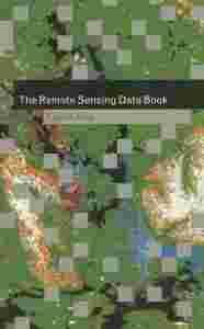
Słownik terminów związanych z teledetekcją
____________
Wydawnictwo Cambridge University Press 1999
Stron 276
Wymiary: 23,5 x 15,5 x 2 cm
Książka w języku angielskim
Oznaczenia biblioteczne, poza tym stan bardzo dobry, bez podkreśleń w tekście
Na innej aukcji wystawiam Lillesanda i Kiefera REMOTE SENSING AND IMAGE INTERPRETATION
____________
|
DARMOWA WYSYŁKA W POLSCE PRZY JEDNORAZOWYM ZAKUPIE NA MINIMUM 7 AUKCJACH !!!
(z wyjątkiem przedmiotów o wartości mniejszej niż 2,50 zł)
ZOBACZ POZOSTAŁE AUKCJE !!!
ZAKUP NA KILKU AUKCJACH - JEDEN KOSZT WYSYŁKI (jak przy aukcji, na której jest on najwyższy).
OPCJE WPŁATY:
1) PayU - najsprawniej i najbezpieczniej (kartą Visa, Master Card lub e-przelewem),
2) Na konto bankowe
WYSYŁKA INPOST, EWENTUALNIE DO MNIEJSZYCH MIEJSCOWOŚCI POCZTA POLSKA.
International customers
SHIPPING WORLDWIDE
|
| The Remote Sensing Data Book provides a unique resource of all aspects of remote sensing for the expert and non-expert alike. Organised as a dictionary, it contains over 700 alphabetically-arranged and cross-referenced entries on how remote sensing works, what kinds of data are available, and the large number of satellites and instruments from which the information is obtained. As well as short technical definitions, it also includes longer essays and reviews to give an overview of the subject. Although not a textbook in itself, the data book will serve as a valuable addition to existing textbooks for undergraduates and graduate students on geography, environmental and earth science courses that include an element of remote sensing. It will also be an essential reference for researchers and research managers at all levels using spaceborne remote sensing methods to obtain information about the earth's land, sea, ice and atmosphere.
Author: Gareth Rees, Scott Polar Research Institute, Cambridge
Contributors: Adigun A. Abiodun, Phillip A. Arkin, Robert M. Atlas, Arthur P. Cracknell, Paul J. Curran, Donna Demac, James Foster, Adrian K. Fung, James R. Heirtzler, Kendal McGuffie, Peter J. Mouginis-Mark, W. Gareth Rees, Irwin Scollar, John Turner, Fawwax T. Ulaby
|
|

