Ta strona wykorzystuje pliki cookies. Korzystając ze strony, zgadzasz się na ich użycie. OK Polityka Prywatności Zaakceptuj i zamknij X

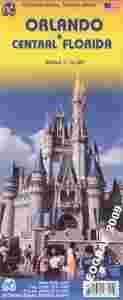
ORLANDO CENTRALNA FLORYDA plan miasta mapa ITMB

11-03-2015, 19:06
Aukcja w czasie sprawdzania nie była zakończona.
Cena kup teraz: 39.90 zł     
Użytkownik GEOGRAF_2009
numer aukcji: 5076393491
Miejscowość Żarki
Wyświetleń: 10   

Dodatkowe informacje:
Stan: Nowy
Waga (z opakowaniem): 0.10 [kg]
Okładka: miękka
Rok wydania (xxxx): 2008
Kondycja: bez śladów używania
Język: angielski
Typ publikacji: mapa samochodowa
info Niektóre dane mogą być zasłonięte. Żeby je odsłonić przepisz token po prawej stronie. captcha

Opis produktu

Orlando and Central Florida

ORLANDO I ŚRODKOWA FLORYDA

plan miasta / mapa samochodowa w skali

1:12 500 / 1:400 000

kanadyjskiego wydawnictwa ITMB

ITMB Publishing (International Travel Maps and Books) producentem map i atlasów krajów i regionów całego świata. Specjalizującą się w Afryce, Azji, Kanadzie, Karaibach, Europie, Bliskim Wschodzie i Ameryce Łacińskiej.


ITMB’s Orlando and Central Florida combines a coast-to-coast road map of the central part of the state with four more detailed maps: Disney World, International Drive with the Sea World, a large plan of central Orlando, and a map of the wider region of the city including access to Disney World.

On one side is a road map at 1:400,000 of the central part of Florida covering the Space Coast and the Treasure Coast between Edgewater and Jupiter on the Atlantic side, and the Sun Coast plus the Nature Coast on the Gulf of Mexico, including Saint Petersburg, Tampa and Sarasota. Road network is neatly presented with road numbers on all roads and driving distance on federal and state highways. Toll plazas, services and rest areas are indicated and exits from main highways are clearly numbered.


The map also shows railway lines and local airports, plus indicates locations of numerous places of interest, including the area’s main attractions, with some places annotated with brief descriptions, national parks and state forest or other protected areas, Indian Reservations and military zones, etc. The map is indexed, but has no geographical coordinates.

Two thirds of the reverse side are taken up by a clear, indexed street plan of the central districts of Orlando at 1:12,500, extending from the theatres in the Orlando Loch Haven Park to Kaley Street on the south and from Sunset Lake in the west to the Orlando Festival Park. Hotels, places of worship, etc. are highlighted.

A wider region around the city is presented on a road map at 1:150,000 with main highways and connecting roads to the area’s numerous attractions. Also included is a plan of the Walt Disney World Resort at 1:44,000 and a map of the International Drive area including the Sea World, both annotated with hotels and sights.


Język: angielski
ISBN: 978[zasłonięte][zasłonięte]34167
Rok wydania: 2008
Wymiary: 100 x 235 x 10 mm
Ilość stron: 2
skala mapy / planu miasta: 1:12 500 / 1:400 000
Kod kreskowy: 978[zasłonięte][zasłonięte]34167
okładka / oprawa: miękka