Ta strona wykorzystuje pliki cookies. Korzystając ze strony, zgadzasz się na ich użycie. OK Polityka Prywatności Zaakceptuj i zamknij X

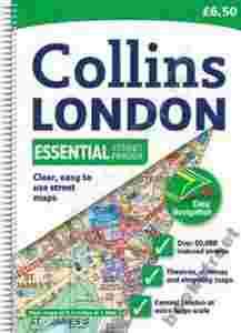
LONDON ESSENTIAL STREET ATLAS

11-03-2015, 0:55
Aukcja w czasie sprawdzania była zakończona.
Cena kup teraz: 999.99 zł     
Użytkownik bookstreet
numer aukcji: 5073615416
Miejscowość Kalisz
Wyświetleń: 2   
Koniec: 11-03-2015, 0:06

Dodatkowe informacje:
Stan: Nowy
Kondycja: bez śladów używania

info Niektóre dane mogą być zasłonięte. Żeby je odsłonić przepisz token po prawej stronie. captcha

978[zasłonięte][zasłonięte]22608, 978[zasłonięte][zasłonięte]73178, 978[zasłonięte][zasłonięte]61949, 978[zasłonięte][zasłonięte]54366, 978[zasłonięte][zasłonięte]95840, 978-[zasłonięte][zasłonięte]22608, 978-[zasłonięte][zasłonięte]73178, 978-[zasłonięte][zasłonięte]61949, 978-[zasłonięte][zasłonięte]54366, 978-[zasłonięte][zasłonięte]95840
TEL: 607-[zasłonięte]-671
GG: [zasłonięte]16851
EMAIL: [zasłonięte]@bookstreet.pl

Kupując kilka książek za wysyłkę płacisz tylko raz! 

Do realizacji zamówienia przystępujemy po otrzymaniu zapłaty za towar lub wybraniu opcji przesyłki za pobraniem. Książki wysyłamy w ciągu 5-7 dni roboczych, nie ma możliwości szybszej realizacji.
Wystawiamy faktury VAT.

London Essential Street Atlas

PRODUCT DETAILS:
Author: Collins Uk
Language: English
Publisher: Collins
Publication Date: 29 April 2010
Dimensions: 13.7 x 2.3 x 19.8 cm
Format: Spiral-bound
Pages: 376
Condition: NEW
Product_ID: AAA7C17883

Scale: 1:20,000 (3.17 inches to 1 mile), Central area 1:10,000 (6.3 inches to 1 mile). This handy little atlas features high quality Collins mapping. A huge amount of detail is contained within the mapping without compromising the clarity. Central London is mapped at a larger scale. MAIN FEATURES An ideal general purpose atlas for residents and business users, it comes in a handy format and covers a large area of London at an easy to read scale. INCLUDES / Extremely clear, attractive, full colour street map with enlarged central area. / Full index to places, street names and places of interest. / Theatres and cinemas map, plus shopping map. / Popular spiral binding. / Colour coded primary routes and public buildings. / Street markets and pedestrian streets. / Borough boundaries plus postal district boundaries and codes. AREA OF COVERAGE Extends from Epping Forest in the north to Chessington in the south and from Heathrow in the west to Bexley in the east. WHO THE PRODUCT IS OF INTEREST TO This atlas, with its huge amount of detail and the clarity of the maps is an essential purchase for all residents and businesses in and around London. Also available with a paperback binding.

Książki wysyłamy w ciągu 5-7 dni roboczych.


LONDON (PHILIP'S STREET ATLAS)

BIG LONDON STREET ATLAS

LONDON STREET ATLAS (SPIRAL) (A-Z STREET ATLAS)

LONDON MINI STREET ATLAS SPL

THE HANDY LONDON MAP AND GUIDE

LONDON POCKET ATLAS