KARPATY
KARPATY UKRAIŃSKIE
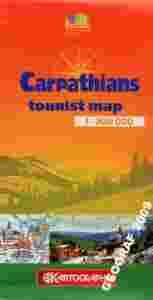
1:300 000
Mapa turystyczna Karpat na terytorium Ukrainy w skali 1:300 000. Mapa swoim zasięgiem obejmuje obszar od Lwowa na północy aż po terytorium Rumunii na południu.
Mapa zawiera plany miejscowości, informacje turystyczne oraz krótkie charakterystki miejsc ciekawych pod względem przyrodniczym jak i zabytkowym.
Mapa jak i legenda mapy są w języku angielskim. Podobnie jak teksty opisowe.
-------------------------------------------------------------------------------------------------------------------------------------------------------
Ukraine’s Carpathian Mountains on a detailed road map from Kartografija Kiev, in an English edition with descriptions of main places of interest plus 12 street plans, each annotated with main sights. All place names are shown transliterated.
The map covers an area from the country’s borders to Lviv in the north and Chernivtsi in the east. Towns are annotated with their foundation dates and, where appropriate, old historical names (e.g. Ivano-Frankovsk - Stanislav). A wide range of symbols highlight various places of interest, some with little drawings of their main monuments. Particularly well covered is the presentation of various botanical, geographical and geological reserves and other natural features.
Road network shows petrol stations and diving distances on main routes. Symbols highlight locations with tourist accommodation. The map has latitude lines at intervals of 10’, with longitude at 15’. The index on the reverse of the map lists places of interest, each with a brief description.
The reverse side also includes a physical map of the region at 1:1,500,000, plus longer descriptions of the country’s numerous national parks and other nature reserves.
Also included are street plans of 12 main towns, each with a list of places of interest annotated on the plan.
Map legend and all the text are in English.