Ta strona wykorzystuje pliki cookies. Korzystając ze strony, zgadzasz się na ich użycie. OK Polityka Prywatności Zaakceptuj i zamknij X

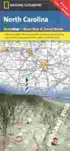
KAROLINA PÓŁNOCNA North Carolina mapa NG 2013 USA

26-04-2014, 0:26
Aukcja w czasie sprawdzania była zakończona.
Cena kup teraz: 33.90 zł     
Użytkownik GEOGRAF_2009
numer aukcji: 4097840747
Miejscowość Żarki
Wyświetleń: 6   
Koniec: 26-04-2014 00:13:42

Dodatkowe informacje:
Stan: Nowy
Okładka: miękka
Rok wydania (xxxx): 2013
Język: angielski
Typ publikacji: mapa samochodowa
info Niektóre dane mogą być zasłonięte. Żeby je odsłonić przepisz token po prawej stronie. captcha

Opis produktu
PÓŁNOCNA KAROLINA


mapa samochodowa
 
1:1 000 000 
 
National Geographic - USA

Mapa samochodowa wodoodporna  jednego z amerykańskich stanów wydana przez National Geographic USA

Dodatkowo zawiera:
plany miast
indeks miejscowości
opisy


North Carolina in a series of US state maps from the National Geographic with cartography from Mapquest, including city maps of Charlotte, Ashevilole, Winston - Salem - Greensboro, Fayetteville, Wilmington, and the Raleigh - Dirham area, an enlargement for the Great Smoky Mountains National Park including the Tennessee part and access to Knoxville, plus a scenic drive route along the Blue Ridge Parkway. The map is printed on lightweight, waterproof and tear-resistant plastic paper.

Maps in the NGS State Series clearly show each state’s national parks, forests and other protected areas, with topography indicated by subtle relief shading and plenty of names of mountain ranges, valleys, deserts, etc. Indian Reservations are also marked and various places of interest are highlighted, including historical or natural sites, visitor information centres, campsites, etc.
Język: ANGIELSKI
Rok wydania: 2013
Wymiary: 23 x 10.5 cm
Ilość stron: 2
Kod kreskowy: 978[zasłonięte][zasłonięte]77505
okładka / oprawa: miękka