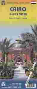
KAIR I DELTA NILUplan miasta w skali 1:12 500 oraz mapa w skali 1:700 000kandyjskiego wydawnictwa ITMB Publishing
Mapa zawiera również: plan piramid w Gizie mapę aglomeracji mapę metra kairskiego
ITMB Publishing (International Travel Maps and Books) producentem map i atlasów krajów i regionów całego świata. Specjalizującą się w Afryce, Azji, Kanadzie, Karaibach, Europie, Bliskim Wschodzie i Ameryce Łacińskiej.
ITMB wydało juz ponad 425 pozycji kartograficznych i stale pracuje nad nowymi wydając rocznie około 30 nowych tytułów.
Cairo is the capital of Egypt, and the largest city in Africa, and the Arab World, as well as one of the most densely populated cities in the world. Cairo is also associated with Ancient Egypt due to its proximity to the Great Sphinx and the pyramids in adjacent Giza.
This is a significant re-working of ITMB's Cairo map, showing a lot of infrastructure improvements and adding rapid transit lines. The real change, however, is the inclusion on the second side of a fully-detailed map of the Nile River from its wide delta to Cairo, where it narrows into the historic narrow band of green southward as far as Luxor at 1:700 000. All known historic sites of ancient Egypt are included.
The map area also includes the Suez Canal, the Gulf of Suez, and the western part of the Sinai. The map is printed on paper and is double-sided.
|