| |
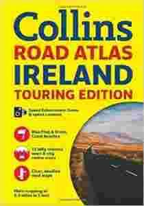
 Ireland Road Atlas (International Road Atlases)
Author: Collins Maps
Language: English
Publisher: Collins
Publication Date: 13 Mar 2014
Dimensions: 29.4 x 21 x 0.8 cm
Format: Paperback
Pages: 64
Condition: NEW
Handy A4 road atlas of the whole of Ireland featuring clear and detailed colour mapping at a scale of 5.2 miles to 1 inch. Perfect for both residents and visitors to Ireland. FEATURES: * Places of tourist interest. * Contact information for Tourist Information Centres with grid references to the mapping. * Fully indexed street maps of 11 cities and towns - Dublin, Belfast, Cork, Limerick, Londonderry (Derry), Galway, Bangor, Waterford, Dun Laoghaire, Drogheda and Killarney. * Speed enforcement zones and fixed location speed cameras. * Blue Flag & Green Coast beaches. * Ferry and airport information, Distance chart, Distances marked on the roads in miles and kilometres. * Route planning map of the whole of Ireland at 15.8 miles to 1 inch. * Administrative map of Irish counties and districts. * Attractive layer colours showing land height. ISBN: 978[zasłonięte][zasłonięte]75412
| | PROSZĘ ZAPOZNAĆ SIĘ Z WARUNKAMI AUKCJI PODANYMI NA DOLE STRONY ORAZ NA STRONIE O MNIE I W TREŚCI WIADOMOŚCI POTWIERDZAJĄCEJ ZAKUP W moim sklepie kupisz najtańsze w Polsce książki w języku angielskim. Jeśli jesteś zainteresowaniy jakąś pozycją, a nie posiadam jej aktualnie wystawionej - proszę o wiadomość - gwarantuję, że u mnie będzie najtaniej! Zapraszam na inne aukcje Wyszukiwanie za pomocją numeru ISBN: WYSZUKIWARKA ISBN JEŚLI ZNAJDZIESZ DANĄ POZYCJĘ TANIEJ U KOGOŚ NA ALLEGRO - PROSZĘ O INFORMACJĘ PRZED ZAKUPEM - U MNIE BĘDZIE JESZCZE TANIEJ! DO KAŻDEJ PRZESYŁKI PACZKĄ POCZTOWĄ LUB KURIEREM DOŁĄCZAM DARMOWĄ KSIĄŻKĘ UŻYWANĄ Z LISTY DOSTĘPNEJ NA STRONIE "O MNIE" Warunkiem otrzymania darmowej książki jest wpisanie jej numeru w formularzu dostawy. Zdjęcie poglądowe - okładki mogą się różnić. | |

