|
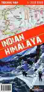
Himalaje Indyjskie – MAPA
Skala map: 1:350 000
Wydawca: terraQuest
- absolutnie wyjątkowa i niepowtarzalna publikacja
- zawiera 22 najpiękniejsze trasy trekkingowe w regionie
- wykonana w specjalnej, nowoczesnej technologii pozwalającej na długotrwałe i wygodne użytkowanie nawet w najtrudniejszych warunkach
- nieoceniona pomoc na himalajskich szlakach
OPIS:
Ta absolutnie wyjątkowa pod wieloma względami mapa, obejmuje swym zasięgiem cały obszar Himalajów Indyjskich, w tym: Kaszmir, Ladakh, Zanskar, Lahul, Rupshu, Spiti, Kinnaur, Garhwal, Kumaon oraz dodatkowo Sikim. Posiada pełną informację turystyczną w raz z rzeźbę terenu. Na mapę zostały dodatkowo naniesione oznaczenia najpiękniejszych tras trekkingowych, które mogą pomóc w zaplanowaniu własnych wędrówek.
W chwili obecnej jest to jedyna na Świecie tak dokładna mapa tego regionu. Opracowywana specjalnie z myślą o osobach aktywnych, wyruszających na trekking w ten trudno dostępny region, wykonana została w nowoczesnej technologii laminatu. Pozwala to nie tylko na dłuższe, ale także na wygodniejsze użytkowanie, nawet w najtrudniejszych warunkach panujących na himalajskich szlakach.
Scale: 1:350 000
Publisher: terraQuest
Description:
This map, absolutely unique in many respects, covers the whole area of the Indian Himalaya, including Kashmir, Ladakh, Zanskar, Lahaul, Rupshu, Spiti, Kinnaur, Garhwal, Kumaon, and (additionally) Sikkim. It provides exhaustive tourist and topographic information. The map is also marked with the most beautiful trekking routes, which may assist map users in planning individual trips.At present, it is the only map in the world that reproduces the configuration of the region in such detail.
It has been specially designed for active people who want to go trekking in this hardly accessible area, and developed with the use of up-to-date laminating technology. Not only does it last longer, but is also easier to handle, even in the harshest weather conditions on Himalayan trails.
|

