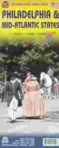
Filadelfia i Północno-Wschodnie wybrzeże USA. Plan miasta i mapa samochodowa wodoodporna 1:10 000 / 1:1 000 000 wyd. ITMB
- Skala: 1:1 000 000, 1:10 000
- Oprawa: miękka
- Liczba stron: 2
- Język: angielski
- Wymiary (mm): 105 x 245
- Kod produktu: 978[zasłonięte][zasłonięte]34169
- ISBN:[zasłonięte]978-1541-692-0
- Typ produktu: plan miasta
- Waga (g): 65
The East Coast of the USA is so densely packed with urban areas and attractions that it is difficult to portray on one map. ITMB has already published Northeast USA at 1:1M scale; this is the adjacent sheet south, as Great Lakes is the Adjacent sheet west. No one seems to have an agreed-upon definition as to what should be included as a Mid-Atlantic State. We included New York State because we wanted NYC to be included and by the shape of the USA had to include parts of Connecticut and Massachusetts unintentionally. The focus of the map is NYC to Raleigh, NC, with New Jersey, Pennsylvania, Washington DC, Delaware, Maryland, Virginia and North Carolina making up the map. In terms of cities, Syracuse and Buffalo are in the north, Pittsburgh (interesting city, by the way) in the far west, and Winston-Salem and Norfolk in the south. This is Civil War country and we have done our best to portray memorials important to both sides of that divisive conflict. This is a regional map, not a thematic one, so our focus has been on showing roads appropriate for a 1:1M scale map.
Legend Includes:
Roads by classification, Airports, Aerodromes and small aircrafts, Ferrie routes, Bus terminals, Metro Stations, Railway stations, Gas stations, Car Parks, Border crossing, State parks with or without campsites, Hospitals, Shopping centres, Postoffices, Police stations, FireStations, Museums, Tourist information centers, Points of interest, , Churches, Mosques, Synagogues, Chinese Temples, Points of Interest, Waterfalls, World heritage sites, Lighthouses, Hot springs, Mines and quarries, Native American reserves, Restaurants, Theatres, Banks, Caves, Embassies, Libraries, Shools, Universities, Banks, Cinemas Hotels, Notable buildings, Zoo, swimming pools, Beaches, Skiing, Tennis courts, Ball fields, Golf courses, Stadiums and much more.


Zobacz nasze pozostałe aukcje |

