Ta strona wykorzystuje pliki cookies. Korzystając ze strony, zgadzasz się na ich użycie. OK Polityka Prywatności Zaakceptuj i zamknij X

Etiopia, Erytrea, Dżibuti, Somaliland 1:2 000 000

27-06-2014, 21:19
Aukcja w czasie sprawdzania była zakończona.
Cena kup teraz: 45.99 zł     
Użytkownik bestmappl
numer aukcji: 4284490175
Miejscowość Poznań
Wyświetleń: 8   
Koniec: 27-06-2014 20:36:06

Dodatkowe informacje:
Stan: Nowy
Okładka: twarda
Rok wydania (xxxx): 2011
Kondycja: bez śladów używania
Typ publikacji: mapa samochodowa
info Niektóre dane mogą być zasłonięte. Żeby je odsłonić przepisz token po prawej stronie. captcha

KONTAKT

logo_bestmap_allegro

NIP: 781[zasłonięte]4798

Regon: 302[zasłonięte]238


Napisz do nas, jeśli:

  • masz pytania dotyczące obsługi zamówień:

[zasłonięte]@bestmap.pl

  • poszukujesz produktu o innychcechach niż na aukcji:

[zasłonięte]@bestmap.pl


Wystawiamy faktury VAT!

BESTMAP_najlepszy_sklep_w_sieci

W PODRÓŻY

Nie od dziś wiadomo, że odpowiednie przygotowanie do podróży lub wycieczki jest gwarancją jej sukcesu. Dlatego właśnie tak istotne jest, aby zabrać ze sobą wszelkiego rodzaju przewodniki turystyczne po miastach, które będzie się zwiedzać, by nie być tylko biernym turystą, a także mapy samochodowe, by nie zagubić się podczas wycieczki autem.


Z nami przygotuj się na najlepsze!


podróż_allegro

Etiopia, Erytrea, Dżibuti, Somaliland 1:2 000 000


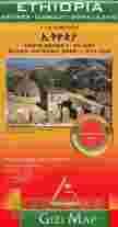
Ethiopia at 1:2,000,000 from Gizi Map with a street plan of central Adis Abeba, plus enlargements of the capital’s environs and the Simen National Park. Excellent presentation of the terrain in the publisher’s characteristic bold altitude colouring with plenty of spot heights and names of peaks, mountain ranges, etc, plus additional graphics for flood plains, swamps, salt flats, deserts, lava fields, wadis and water wells provide a vivid picture of Ethiopia’s geography. National parks or other protected areas and interesting natural sites are highlighted.

Coverage includes Eritrea and Djibouti, extending over the Red Sea to Sana’a and Aden. In the north-west the map extends to Khartoum to cover the whole course of the Blue Nile. Also included is a large part of Somalia, with its regions annotated according to their current (2011) political situation. Where appropriate, disputed boundaries (e.g. the Ilemi Triangle) are indicated. Place names of towns and of the country’s administrative provinces are shown in both Latin and Ethiopian Ge’ez alphabets.

Road network includes selected country tracks, shows locations of border crossings and gives distances on main routes. Railway lines are included and internal airports are marked. Symbols indicate locations with tourist accommodation, campsites, UNESCO World Heritage sites and other places of interest, etc. The map has latitude and longitude lines at intervals of 1°. The index is on the reverse. Map legend includes English and Ethiopian.

Also provided is a large, clear street plan of central Adis Abeba/Addis Ababa highlighting hotels and places of interest, plus an enlargement of the capital’s environs. An enlargement of the Simen/Simien Mountains National Park (1:275,000) shows trekking routes, lodges and campsites.

Rodzaj mapyskładana
Rok wydania (xxxx)2011
Materiał mapypapierowa
Skala1:2 000 000 (1 cm - 20 km)
Format130 x 240
Ilość stron2
StanNowy
ISBN978[zasłonięte][zasłonięte]50100
Kondycjabez śladów używania
Typ publikacjimapa samochodowa
Okładkatwarda

WYSYŁKA

Do trzech dni wysyłka w księgarni turystycznej BESTMAP.

od zaksięgowania wpłaty na naszym koncie

(jeśli w treści aukcji nie podaliśmy inaczej)

DOSTAWA i PŁATNOŚCI

Dostawcy sklepu www.bestmap.pl


Dane do przelewu:

Bank:
Credit Agricole Bank Polska S.A.
 
nr konta:
03 1940 [zasłonięte] 1[zasłonięte]0761885 [zasłonięte] 000000


W przypadku zakupu na kilku naszych aukcjach, otrzymają Państwo wiadomość o kosztach przesyłki. Opłata uzależniona będzie od wagi przedmiotów i z pewnością będzie mniejsza niż opłaty zsumowane z pojedynczych zakupów.

Zapraszamy także na inne nasze aukcje: