Ta strona wykorzystuje pliki cookies. Korzystając ze strony, zgadzasz się na ich użycie. OK Polityka Prywatności Zaakceptuj i zamknij X

DARTMOOR ADVENTURE ATLAS (A-Z ADVENTURE ATLAS)

10-03-2015, 17:57
Aukcja w czasie sprawdzania była zakończona.
Cena kup teraz: 89.25 zł     
Użytkownik bookstreet
numer aukcji: 5072235784
Miejscowość Kalisz
Wyświetleń: 2   
Koniec: 10-03-2015, 17:12

Dodatkowe informacje:
Stan: Nowy
Okładka: miękka
Kondycja: bez śladów używania

info Niektóre dane mogą być zasłonięte. Żeby je odsłonić przepisz token po prawej stronie. captcha

978[zasłonięte][zasłonięte]34885, 978[zasłonięte][zasłonięte]93677, 978[zasłonięte][zasłonięte]78317, 978[zasłonięte][zasłonięte]90887, 978[zasłonięte][zasłonięte]55482, 978-[zasłonięte][zasłonięte]34885, 978-[zasłonięte][zasłonięte]93677, 978-[zasłonięte][zasłonięte]78317, 978-[zasłonięte][zasłonięte]90887, 978-[zasłonięte][zasłonięte]55482
TEL: 607-[zasłonięte]-671
GG: [zasłonięte]16851
EMAIL: [zasłonięte]@bookstreet.pl

Kupując kilka książek za wysyłkę płacisz tylko raz! 

Do realizacji zamówienia przystępujemy po otrzymaniu zapłaty za towar lub wybraniu opcji przesyłki za pobraniem. Książki wysyłamy w ciągu 5-7 dni roboczych, nie ma możliwości szybszej realizacji.
Wystawiamy faktury VAT.

Dartmoor Adventure Atlas (A-Z Adventure Atlas)

PRODUCT DETAILS:
Author: Geographers' A-Z Map Company
Language: English
Publisher: Geographers' A-Z Map Co Ltd
Publication Date: 1 April 2012
Dimensions: 23.4 x 13 x 1.4 cm
Format: Paperback
Pages: 80
Condition: NEW
Product_ID: 1D4C4DD54X

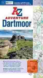
The A-Z Adventure series features the accuracy and quality of the 25k OS Explorer mapping in a convenient book, complete with index. The A-Z Adventure series is an innovative concept that utilises Ordnance Survey Explorer mapping in a book, therefore eliminating the need to fold and re-fold a large sheet map to the desired area. OS Explorer is Ordnance Survey's most detailed mapping at a scale of 1:25 000, showing public rights of way, open access land, national parks, tourist information, car parks, public houses and camping and caravan sites. Unlike the original OS sheets, this A-Z Adventure Atlas includes a comprehensive index to towns, villages, hamlets and locations, natural features, nature reserves, car parks and youth hostels, making it quick and easy to use. Each index entry has a page reference and a six figure National Grid Reference. At a book size of 240mm x 134mm it is the same size as a standard OS Explorer map when closed. This A-Z Adventure Atlas of Dartmoor features 70 pages of continuous Ordnance Survey mapping covering: Dartmoor National Park Okehampton (part) Bovey Tracey Buckfastleigh Tavistock (part) This A-Z Adventure Atlas, covering Dartmoor National Park, has the accuracy and quality of OS Explorer mapping and is indexed within a single book, making it the perfect companion for walkers, off-road cyclists, horse riders and anyone wishing to explore this beautiful landscape

Książki wysyłamy w ciągu 5-7 dni roboczych.


WALK DARTMOOR Kate Hobbs, Alan Hobbs

DARTMOOR NATIONAL PARK Andrew Cooper

SNOWDONIA ADVENTURE ATLAS

SW COAST PATH SOUTH CORNWALL ADVENTURE ATLAS

SW COAST PATH SOUTH DEVON ADVENTURE ATLAS

DARTMOOR: INTO THE WILDERNESS Michelle Dibb