Ta strona wykorzystuje pliki cookies. Korzystając ze strony, zgadzasz się na ich użycie. OK Polityka Prywatności Zaakceptuj i zamknij X

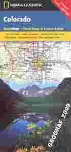
COLORADO mapa samochodowa NATIONAL GEOGRAPHIC USA

01-01-2015, 1:19
Aukcja w czasie sprawdzania była zakończona.
Cena kup teraz: 34.90 zł     
Użytkownik GEOGRAF_2009
numer aukcji: 4857951274
Miejscowość Żarki
Wyświetleń: 1   
Koniec: 01-01-2015 01:13:53

Dodatkowe informacje:
Stan: Nowy
Waga (z opakowaniem): 0.10 [kg]
Okładka: miękka
Rok wydania (xxxx): 2006
Kondycja: bez śladów używania
Język: angielski
Typ publikacji: mapa samochodowa
info Niektóre dane mogą być zasłonięte. Żeby je odsłonić przepisz token po prawej stronie. captcha

Opis produktu
COLORADO


mapa samochodowa wodoodporna

National Geographic - USA


Colorado in a series of US state maps from the National Geographic with cartography from Mapquest, including city maps for the Denver area, downtown Denver, Colorado Springs, Pueblo and Fort Collins, enlargements of the Rocky Mountain and Mesa Verde National Parks, plus a scenic drive route along the San Juan Skyway. The map is printed on lightweight, waterproof and tear-resistant plastic paper. Maps in the NGS State Series clearly show each state’s national parks, forests and other protected areas, with topography indicated by subtle relief shading and plenty of names of mountain ranges, valleys, deserts, etc. Indian Reservations are also marked and various places of interest are highlighted, including historical or natural sites, visitor information centres, campsites, etc. Road network indicates toll roads, rest areas and services, and shows driving distances on main routes. Scenic roads are highlighted. The maps have no geographical coordinates. The index lists both counties, shown on the maps with their administrative boundaries, and towns or cities. Each title includes several enlargements showing in greater detail local towns, national parks and other popular destination, all annotated with places of interest. Also provided are general notes about the state with descriptions of its main sights, a recommendation for a scenic drive, a table of services available in the local sites (both national parks and historical monuments), a calendar of local special events, a distance table and a climate chart.

Język: angielski
ISBN: 978[zasłonięte][zasłonięte]77507
Rok wydania: 2006
Wymiary: 22.5 x 10.5 cm
Ilość stron: 2
skala mapy / planu miasta: różne skale map i planów miejscowości
Kod kreskowy: 978[zasłonięte][zasłonięte]77507
okładka / oprawa: miękka