|
____________
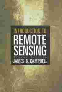
Wydawnictwo The Guilford Press. New York - London 1996
Stron 652
Wymiary: 24 x 17 cm
Książka w języku angielskim
Na trzech stronach spisu treści plamki po kawie, co nie przeszkadza w czytelności tekstu, poza tym stan książki bardzo dobry
Zobacz na moich aukcjach pozostałe książki o podobnej tematyce!
____________
|
DARMOWA WYSYŁKA W POLSCE PRZY JEDNORAZOWYM ZAKUPIE NA MINIMUM 7 AUKCJACH !!!
(z wyjątkiem przedmiotów o wartości mniejszej niż 2,50 zł)
ZOBACZ POZOSTAŁE AUKCJE !!!
ZAKUP NA KILKU AUKCJACH - JEDEN KOSZT WYSYŁKI (jak przy aukcji, na której jest on najwyższy).
OPCJE WPŁATY:
1) PayU - najsprawniej i najbezpieczniej (kartą Visa, Master Card lub e-przelewem),
2) Na konto bankowe
WYSYŁKA INPOST, EWENTUALNIE DO MNIEJSZYCH MIEJSCOWOŚCI POCZTA POLSKA.
International customers
SHIPPING WORLDWIDE
|
| Reviews:
"This text is irreplaceable and has stood the test of time. It is a godsend for my remote sensing classes; students are guided by the book's logical structure, authoritative writing, liberal use of examples, and clear illustrations. The fifth edition offers an excellent opportunity to brush up on the rapidly changing face of remote sensing, as underlined by a separate chapter on change detection."--Victor Mesev, Department of Geography, Florida State University
"Introduction to Remote Sensing deserves its excellent reputation as one of the preeminent textbooks for undergraduate courses in remote sensing and image processing. It has proven very economical for my students as I can use it in complementary courses on introductory remote sensing and image processing. Like prior editions, the fifth edition provides students with critical information on how to design and conduct a remote sensing project, including acquisition of field data. Comprehensive and up to date, this is an essential text for our dynamic discipline."--Paul Treitz, Department of Geography, Queen’s University, Canada
"Introduction to Remote Sensing is the cornerstone of the reading list for my undergraduate environmental remote sensing course. The book is structured to have a clear and logical progression that guides students into the subject and builds a comprehensive knowledge base. Each chapter is highly informative, providing information that is easy to digest and fully contextualized with relevant examples and suitable illustrations. The revised questions at the end of each chapter provide an excellent opportunity for reflective learning. Overall, this book is an essential read for my students which has proven over the years to stand them in good stead."--Ross Hill, School of Applied Sciences, Bournemouth University, United Kingdom
"This well-established introductory textbook covers all aspects of classical remote sensing, from basic physics and image acquisition to analytic techniques and applications in a wide range of areas. Given the continued rapid development of remote sensing--for example, the increased use of satellite imagery, digital cameras, and Lidar--the publication of the fifth edition is timely. As a teacher, I find the list of relevant Web addresses after most chapters to be especially valuable."--Håkan Olsson, Department of Forest Research Management, Swedish University of Agricultural Sciences
"An outstanding guide to the student as well as the experienced user of remotely sensed data. The book provides a clear overview and context for further study. The transition from analog to digital is explained extremely well without leaving out the fundamentals required to have a complete understanding. New topics including object-based image analysis are included. This book is an excellent text for an introductory remote sensing course. It is also an appropriate addition to anyone's library who is trying hard to keep up with all the changes in the remote sensing technology. This book has a valued place on my bookshelf."--Photogrammetric Engineering and Remote Sensing
(Photogrammetric Engineering and Remote Sensing 2[zasłonięte]012-06)
Author:
James B. Campbell is Professor of Geography at Virginia Tech, where he teaches remote sensing, quantitative methods, and geomorphology. He has worked closely with students and faculty in related fields such as forestry, geology, agronomy, environmental sciences, and planning. Since 1997 he has served as Codirector of Virginia Tech’s Center for Environmental Applications of Remote Sensing (CEARS). The author of numerous technical articles and several books, Dr. Campbell has received the Outstanding Service Award and the Fellow Award of the American Society for Photogrammetry and Remote Sensing. He is also a recipient of the Outstanding Service Medal awarded by the Remote Sensing Specialty Group of the Association of American Geographers. Dr. Campbell has been active in the AmericaView Program, including service as a principal investigator for the VirginiaView consortium and as a member and chair of the AmericaView Board of Directors.
|
|

