Ta strona wykorzystuje pliki cookies. Korzystając ze strony, zgadzasz się na ich użycie. OK Polityka Prywatności Zaakceptuj i zamknij X

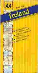
ATS - AA Ireland Road Map
18-06-2014, 10:01
Aukcja w czasie sprawdzania była zakończona.
Cena kup teraz: 4 zł     
Użytkownik AllThatStuff
numer aukcji: 4254908423
Miejscowość Warszawa
Wyświetleń: 2   
Koniec: 18-06-2014 09:58:25

Dodatkowe informacje:
Stan: Używany
Waga (z opakowaniem): 0.12 [kg]
Rok wydania (xxxx): 1996
Typ publikacji: mapa samochodowa
info Niektóre dane mogą być zasłonięte. Żeby je odsłonić przepisz token po prawej stronie. captcha


Automobile Association

Road Map

Ireland


Scale: 1:350 000


Automobile Association UK 1996
stan dobry, kilka rozdarć na zagięciach, jedno sklejone
format 14 x 27 cm / po rozłożeniu 130 x 77 cm
waga 125 g


A sheet map of Ireland which contains new digital Irish mapping at a scale of approximately five-and-a-half miles to the inch. It shows motorways, A & B roads, border custom posts, mileages between main towns and points of interest. It is fully indexed. The map is two sided, with Northern Ireland on one side and the Republic of Ireland on the other. Also included are town plans of Belfast and Dublin, a counties map and a mileage chart.