ALGIERIA
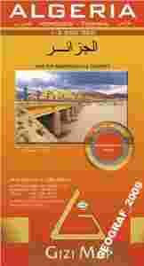
ALGERIA geographical map
mapa geograficzna (drogowa)
w skali 1:2 500 000wydawca: GIZIMAP
Algieria, Maroko, Tunezja. (Algeria, Morocco, Tunisia)Mapa geograficzno-drogowa 1:2 500 000.Afryka, północna Afryka, Sahara, Zachodnia Sahara, Algier (Al Jaz'ir), Rabat, Tunis.Obejmuje Algierię, Maroko i Tunezję oraz zachodnią Libię i południową Hiszpanię.Zabytki, hotele turystyczne, kąpieliska. Miejsca interesujące turystycznie.Plaże, miejsca do nurkowania.Delikatny relief z cieniowaniem. Hipsometria.Indeks miejscowości.Nazwy miejscowości i nazwy geograficzne, również w języku arabskim.Legenda w 6 językach. Dla turystów i biznesmanów.rozmiar po rozłożeniu: 92x87 cm
A detailed general map with relief depicted by vivid elevation tinting. The map is indexed and selected location names are written in Arabic as well as standard roman text. Coverage includes neighbouring Tunisia and most of Morocco. Terrain features such as sand deserts, stone deserts, salt flats, water holes and swamps are distinguished, and selected peak heights are indicated. Bathymetric tinting is also applied.
Several categories of roads are distinguished, including selected tracks, with intermediate driving distances marked on many routes. Railways, oil and gas piplines, and administrative boundaries are drawn and symbols denote oil and gas production sites, airports, ports, places of worship, campsites, hostels, beach resorts, oases, lighthouses, forts, museums, UNESCO sites and other antiquities and sites of interest. Lines of latitude and longitude are drawn at 1° intervals. The multilingual legend includes English and Arabic. A wallmap version of this map is also available on our website.
This map differs from the Algeria (Road edition) by the same publisher in the depiction of the relief, otherwise the detail is the same.